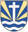
Žiar nad Hronom (Okres Žiar nad Hronom)
 |
The name of the settlement has gone through multiple developments. Prior to 1237, the settlement was known as a place with a toll station. In 1237, first name of the settlmenet emerges, as a combination of Latin and Hungarian, with the town called Cristur (later Kerestúr), which translates to The Cross of the Lord. Back then, the settlement was split between the dominions of the Šášov castle and the Benedictine Abbey of Hronský Beňadik.
In 1773, the village was known as Holy Cross, in various language versions, including Latin (Sancta Crux), Hungarian (Szent Kereszt), German (Heiligs Creütz) or Slovak (Swaty Kriss). Similar names were recorded in 1808, despite minor influence caused by linguistic developments. In 1873, Hungarian name Barsszentkereszt is used, but the same changes at the turn of the 19th and 20th century into Garamszentkereszt (translates to: The Holy Cross upon Hron).
After the formation of the First Czechoslovak Republic, the settlmenet was known as Svätý Kríž nad Hronom in Slovak, copying the earlier Hungarian name. Although, historically synonymous with the settlement, the name Kerestúr was used by Zemplínska Teplica in the early 20th century. In May 1953, when aluminum manufacturing and metallurgy began to flourish in the settlement, it impacted the life and the name of the city. In combination with the anti-religious sentiment of the Czechoslovak Socialist Republic, the name was changed to the current version Žiar nad Hronom, which translates to glare upon Hron.
Map - Žiar nad Hronom (Okres Žiar nad Hronom)
Map


Country - Slovakia
 |
 |
| Flag of Slovakia | |
The Slavs arrived in the territory of present-day Slovakia in the fifth and sixth centuries. In the seventh century, they played a significant role in the creation of Samo's Empire. In the ninth century, they established the Principality of Nitra, which was later conquered by the Principality of Moravia to establish Great Moravia. In the 10th century, after the dissolution of Great Moravia, the territory was integrated into the Principality of Hungary, which then became the Kingdom of Hungary in 1000. In 1241 and 1242, after the Mongol invasion of Europe, much of the territory was destroyed. The area was recovered largely thanks to Béla IV of Hungary, who also settled Germans, leading them to become an important ethnic group in the area, especially in what are today parts of central and eastern Slovakia.
Currency / Language
| ISO | Currency | Symbol | Significant figures |
|---|---|---|---|
| EUR | Euro | € | 2 |
| ISO | Language |
|---|---|
| HU | Hungarian language |
| SK | Slovak language |